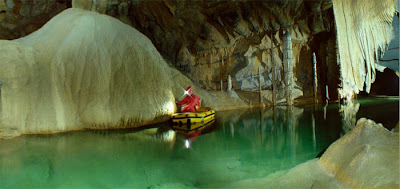
On the romantic tropical island of Palawan in the far western reaches of the Philippines, there is a river that is navigable for more than 5 miles…underground.
Azure waters, crystal clear and inviting, mark the entrance to the world’s second longest subterranean watercourse. An few hours away from the city of Puerto Princesa and a short boat ride from the Sheridan Resort, Sabang, yet a step back in time to an age when the earth was still young.
Underground Rivers
A subterranean river, more popularly known as an underground river, is a river that runs wholly or partly beneath the ground surface – one where the riverbed does not represent the surface of the Earth.
Monday, January 17, 2011
Phong Nha – Ke Bang National Park, Vietnam
Phong Nha – Ke Bang National Park lies in Quang Binh Province - the central Vietnam. Covering an area of about 200,000 hectares, Phong Nha – Ke Bang situated in Quang Ninh, Bo Trach, Tuyen Hoa and Minh Hoa districts, is 50km northwest of Dong Hoi City.
Phong Nha - Ke Bang karst mountains can provide a lot of valuable information about the Earth's prolonged geological process through various periods, from the Paleozoic (about 400 million year ago) to the Carboniferous and Permian (340-240 million years ago). It is also noteworthy to mention a geological characteristic – the system of underground rivers and grottos in limestone mountains.
Locating in the area with a high average rainfall, however, few rivers and streams can be seen because water is absorbed to run inside limestone mountains. Therefore over tens of million years, water has eroded rocks, creating numerous caves in the area. The Phong Nha grotto system has evaluated as the most value in the world by the British Cave Research Association which held several world cave records, as it has the longest underground river, highest and widest entrance, the most beautiful sand and rock banks, the most magnificent and fanciful stalactites and stalagmites.
The Sistema Sac Actun
Sistema Sac Actun, or white cave system, is considered one of the longest surveyed underwater cave system in the world. Located in the State of Quintana Roo in Mexico's Yucatan Peninsula, it runs along the Caribbean coast and has passages west and north of Tulum, the site of Pre-Columbia Mayan ruins. Measuring over a hundred and nine miles, it is the second longest underwater cave system, after Sistema Ox Bel Ha, or "three paths of water", which is also located in Quitana Roo and is just four-tenths of a mile longer than Sistema Sac Actun. The caves are always filled with water at a seventy-six degree Fahrenheit temperature. Layers of water, with freshwater on top of salt water, flood the caves, most of which become trapped in the rock. Throughout the Yucatan Peninsula are sinkholes through which divers can access the underground water caves.
The underground water-filled caves were formed millions of years ago and are a remarkable natural resource. This system maintained the Mayan's need for water for centuries and is still the main source of fresh water for the region.
The underground water-filled caves were formed millions of years ago and are a remarkable natural resource. This system maintained the Mayan's need for water for centuries and is still the main source of fresh water for the region.
The Santa Fe River in northern Florida
Located north of High Springs, Florida, the Santa Fe River flows from River Rise to the Suwannee River. It is officially designated as part of Florida’s Statewide System of Greenways and Trails.
This beautiful trail begins in O’Leno State Park, where the Santa Fe reappears after flowing underground for more than three miles. This tributary of the Suwannee River curves past hardwood hammocks and through river swamps. Many clear springs feed the Santa Fe. There are some small shoals during low water, but they are almost always passable. Wildlife is abundant along the trail. Look for turtles, alligators, and wading birds. The trail ends three miles upstream of the confluence of the Santa Fe and the Suwannee River.
This beautiful trail begins in O’Leno State Park, where the Santa Fe reappears after flowing underground for more than three miles. This tributary of the Suwannee River curves past hardwood hammocks and through river swamps. Many clear springs feed the Santa Fe. There are some small shoals during low water, but they are almost always passable. Wildlife is abundant along the trail. Look for turtles, alligators, and wading birds. The trail ends three miles upstream of the confluence of the Santa Fe and the Suwannee River.
The Mojave River in southern California
The Mojave River flows underground in most places and crosses portions of the Mojave Desert. The source of the Mojave River is in the San Bernardino Mountains, just west of Lake Arrowhead. It is dammed to form Silverwood Lake, then flows north through Victorville to Barstow.
From Barstow, the river slows east through Afton Canyon to the Mojave River Sink and Soda Lake. In extraordinary years, water can flow from Soda Lake north through Baker to Silver Lake and Silurian Lake, to join the Amargosa River as it flows into Death Valley.
From Barstow, the river slows east through Afton Canyon to the Mojave River Sink and Soda Lake. In extraordinary years, water can flow from Soda Lake north through Baker to Silver Lake and Silurian Lake, to join the Amargosa River as it flows into Death Valley.
The Lost River in the Appalachian Mountains of West Virginia
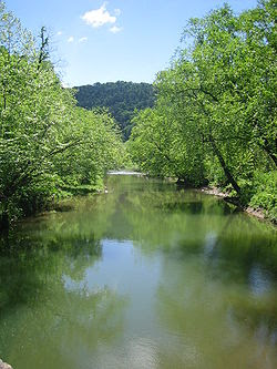
The Lost River is located in the Appalachian Mountains of Hardy County in West Virginia's Eastern Panhandle region. The Lost River is geologically the same river as the Cacapon River but flows into an underground channel northeast of Baker along West Virginia Route 259 at "the Sinks" and reappears near Wardensville as the Cacapon.
The source of the Lost River lies south of Mathias near the West Virginia/Virginia border. Along with the Cacapon and North rivers, the Lost River serves as one of the three main segments of the Cacapon River and its watershed.
The source of the Lost River lies south of Mathias near the West Virginia/Virginia border. Along with the Cacapon and North rivers, the Lost River serves as one of the three main segments of the Cacapon River and its watershed.
The Križna cave system in Loška dolina, Slovenia
A very particular cave among all carst caves is Križna cave. It’s entrance with the Medvedov rov (Bear passage) is known from the 19th century. The cave is an abundant location of the bones of cave bear.
The most special thing about Križna cave are it’s 22 lakes with calcareous sinter barriers. A short tour till the firts lake takes about one hour, the longer tour takes about 4 hours.
The most special thing about Križna cave are it’s 22 lakes with calcareous sinter barriers. A short tour till the firts lake takes about one hour, the longer tour takes about 4 hours.
Subscribe to:
Posts (Atom)


